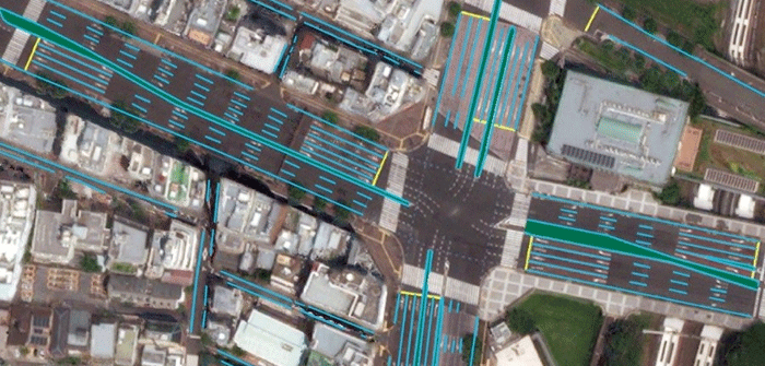
Toyota’s automated driving software development company, Toyota Research Institute-Advanced Development, Inc. (TRI-AD), is partnering with Maxar Technologies Inc., a global technology innovator powering the new space economy, and leading IT services provider NTT DATA Corporation to collaborate on a proof-of-concept (POC) building HD maps using photographs from space.
The project is an important move toward advancing TRI-AD’s open software platform concept known as Automated Mapping Platform (AMP) and will help realize the scalability of autonomous driving. CAVs use several real-time sensors to ensure safe driving and these sensors need to be cross-referenced with an HD map for safe operation.
 The project is an important move toward advancing TRI-AD’s open software platform concept known as Automated Mapping Platform (AMP) and will help realize the scalability of autonomous driving. CAVs use several real-time sensors to ensure safe driving and these sensors need to be cross-referenced with an HD map for safe operation.